
PBO contributor Alan Watson reports on the Innovation in Maritime Navigation conference, hosted by the Royal Institute of Navigation at Trinity House, London

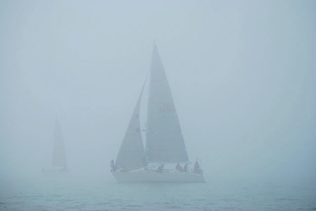
The conference on 2 March was well attended both from UK and overseas representatives and grappled with the problem of future maritime navigation becoming more complex and demanding with more and bigger ships in more congested waters and with increasing concern about the vulnerability of GPS.
A theme that ran through the day was that of more complex electronic navigation systems and greater reliability on them, such that basic navigational skills were being lost. If the electronic system failed due to an on board problem or loss of GPS, there was no reliable fall-back.
The technologists offered solutions including inertial navigators, ranging from MF beacons, radar positioning, position fixing from broadcast transmitters and then into the future with Quantum technologies use cold atom sensing of rotation and acceleration and looks both complex and expensive. Ironically the most promising alternative to GPS, eLoran is facing an uncertain future after the switch off of European transmitters.
Inertial navigation seemed promising as an electronic way of dead reckoning during a short GPS outage but even very expensive military systems suffer from drift and will have built up a significant error in hours.
Position fixing from radar will be familiar to many readers as will using MF beacons. Radar positioning could be enhanced by adding more Racons around the coast. The MF beacons exist already and are used for differential GPS transmissions but could be adapted for range measurement. One intriguing suggestion is using broadcast TV and radio transmitters as signal sources for position fixing.
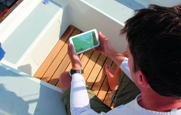
Turning to present systems at sea, there was concern about the diversity of these such that an officer joining a ship cannot necessarily expect to be familiar with the system on board. There is also growing use of “unapproved” systems on tablets and smartphones which use non approved (for big ship) chart sources with attendant dangers. An example of one of these was shown where the Varne light vessel in the Dover Strait had disappeared.
The conclusion though was that there is no single simple technology solution to overcome the concerns and that traditional navigation skills from the “pre digital age” need to be transferred to the younger generation of mariners. Time to dust off that sextant!

Nav in a nutshell: Coping with currents
Dick Everitt explains how sailors can apply knowledge of tidal streams to ensure that water flow is a help, not…
14 iPad and Android navigation apps tested
Gear test following an explosion in the number of marine navigation apps available for iPad and Android devices in the…

Nav in a nutshell: Looks good on paper
Up-to-date printed paper charts are a good bet for identifying your position – but they do have their limits, says…

Warning not to use LED bulbs in filament bulb navigation lights
Replacing filament bulbs with white LEDs in tricolour navigational lights could result in vessels not being insured, the Cruising Association…

Nav in a nutshell: Navigate with radar
Dick Everitt gives us a clear picture of the advantages to be gained from using radar to check our navigation

A handy guide to using traditional skills for navigation
PBO contributor Sticky Stapylton shows how to work out an estimated position and course to steer

Nav in a nutshell: Navigating at night
There’s no need to be in the dark if your preparation is thorough and easy to understand, says Dick Everitt…

Using a laptop for navigation on board?
Here's a way to use less power

Nav in a Nutshell: Lighthouse characteristics on charts
Dick Everitt helps illuminate our understanding of lighthouse characteristics on charts, their dipping distances and loom...
Nav in a Nutshell: Navigate by ‘feel’ using an echo sounder
The ‘ping’ is king: You can navigate by ‘feel’ over the seabed in adverse conditions by using an echo sounder…

Navigation by eye – what is a Kamal?
DIY sextant

Nav in a nutshell: Electronic charts
Dick Everitt assesses the differences between raster and vector charts when deciding on which chart plotter to buy

Nav in a Nutshell: What is a transit and how are they used in navigation
Lining up a pair of appropriate land features or navigation marks can help keep you safe, as Dick Everitt explains

Notice to Mariners: Underwater horse sculptures
Four horse sculptures that rise out of the water at low tide are providing a temporary hazard to navigation on…
Nav in a Nutshell: Clearing bearings
In the first of his series on back-to-basics navigation Dick Everitt explains how to use a few simple lines to…