
Dick Everitt explains how sailors can apply knowledge of tidal streams to ensure that water flow is a help, not a hindrance
Currents and tidal streams speed us up, slow us down or push us sideways. So we need to know roughly how strong they are, and in which direction they’re going, writes Dick Everitt.
An Admiralty Tidal Stream Atlas has a page for each hour of the tidal cycle, based on the time of high water at Dover, so we just need to look up the relevant time of high water in the Dover tide table and write it in on the ‘high water’ page of the atlas, then fill in the ascending and descending times on the top of other pages.
Always use a pencil, so it can be rubbed out and the atlas used again and again.
Each page has dozens of little arrows showing how the streams’ direction changes each hour, with small numbers showing their speeds. For example, 05,19 means 0.5 knots at Neaps and 1.9 knots at Springs – and the comma is the position where they were measured.
But if we’re between Springs and Neaps we can use the graph in the atlas to calculate the difference, based on the tidal range for the day – or just guesstimate it!
The tiny arrows in tidal atlases, or computer programs, are the simplest to understand as they are the most graphic – but tidal diamonds on charts do a similar job, in tabular form, giving the direction in degrees true and the rate (speed) in knots. Normally the figures are quite accurate, but because we now have GPS showing our speed over the ground, tidal anomalies do show up.
A mate of mine was surprised when his little boat reached 16 knots SOG off Northern Ireland, where the maximum tide was only supposed to be 6 knots, but he was thankful for the tidal atlas’ warning of a predicted 12-knot tidal stream in the Pentland Firth!
Mind you, periods of prolonged gales can set up strong surface currents that can upset tidal calculations. For instance, north-west gales in the Bay of Biscay can set up a 5-knot current along the northern Spanish coast, and exotic ocean currents in the Indian Ocean can reverse with the monsoon winds. Even temperature changes can affect currents (El Niño, etc) so canny sailors in the Sydney Hobart Yacht Race check websites for the position of a changing, swirling mass of water that can give them a 1- or 2-knot lift.

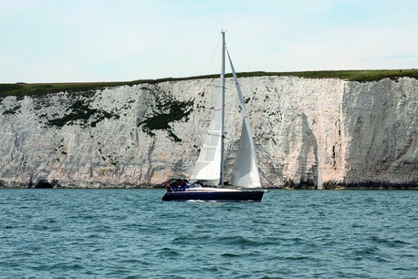
You need to tuck in close to Longships lighthouse to get the benefit of the inshore eddy off Land’s End
Useful eddies
On a more prosaic level, when just coasting around the UK, the tide turns about every six hours – but not always at the times of high or low water. Often the tidal stream turns earlier inshore and later as you get further away from the coast, so you need to study the relevant pages of the tidal atlas quite closely.
It’s not an exact science, and all sorts of things can upset it. Heavy rain can cause stronger currents to rush out of loughs and rivers, and tidal stream directions can change as the water covers or uncovers sandbanks.
The shape of the sea bottom can also affect the water fl ow, so take care if there’s a headland sticking out into the sea as there might be the remains of an older bit below the waves. This sudden uprise in the seabed can often cause the water flow to speed up and create the nasty waves of a tidal race.
Conversely, in a harbour or estuary, the friction of the shallow edges of the channel can slow the water down: so if you need to sail in, against the tide, keep out of the strong current in the middle of the channel by staying in the shallows.
The shape of the coastline can also alter things by making the tidal streams flow into bays and form back-eddies as they swirl around headlands, etc. There’s a handy one close in by Land’s End that lets you sneak south when the main stream is flowing north (see diagram).

An extract from the PBO Small Craft Almanac showing nearly six hours of south-fl owing inshore tide, when the offshore tide is going north
Some local pilot books and old tidal atlases have far more of these useful eddies shown than the modern Admiralty atlases so it’s well worth keeping an eye out for them at boatjumbles, as this sort of tidal information rarely dates.
I remember one old pilot book saying you could take the inner passage around Portland Bill in settled weather ‘if you stay within a pistol shot of the shore’!
If you’re heading for blue water, get a copy of Ocean Passages for the World. The older editions have proper dark blue hard covers and are stuffed full of useful information about ocean currents, winds, ice etc, and were originally aimed at helping sailing ship skippers.
‘Tidal gates’
If you’re not crossing oceans, you need to make sure that you plan for favourable tides so you get through any ‘tidal gates’ before the tide turns foul. The PBO Almanac has several pages of these ‘tidal gates’ around the UK with approximate times and strengths.
Try to glean as much local knowledge as you can from pilot books, online forums and other sailors before you set off – and don’t be shy about asking for local advice by radio, or phone, from friendly harbour masters while on passage.
This Nav in a Nutshell was published in the December 2011 issue of PBO. For more useful archive articles explore the PBO copy shop.
Nav in a Nutshell: Clearing bearings
In the first of his series on back-to-basics navigation Dick Everitt explains how to use a few simple lines to…

Nav in a Nutshell: What is a transit and how are they used in navigation
Lining up a pair of appropriate land features or navigation marks can help keep you safe, as Dick Everitt explains
Nav in a Nutshell: Navigate by ‘feel’ using an echo sounder
The ‘ping’ is king: You can navigate by ‘feel’ over the seabed in adverse conditions by using an echo sounder…

Nav in a Nutshell: Lighthouse characteristics on charts
Dick Everitt helps illuminate our understanding of lighthouse characteristics on charts, their dipping distances and loom...

Nav in a nutshell: Navigating at night
There’s no need to be in the dark if your preparation is thorough and easy to understand, says Dick Everitt…

‘Ghost yacht’ sunk by Irish Naval Service after crossing the Atlantic
A yacht that crossed the Atlantic after being abandoned more than a year ago has been sunk just as its…

Nav in a nutshell: Navigate with radar
Dick Everitt gives us a clear picture of the advantages to be gained from using radar to check our navigation

Nav in a nutshell: Looks good on paper
Up-to-date printed paper charts are a good bet for identifying your position – but they do have their limits, says…

Nav in a nutshell: Electronic charts
Dick Everitt assesses the differences between raster and vector charts when deciding on which chart plotter to buy

Mooring contractor prosecuted for causing navigational hazard
The Port of Milford Haven has successfully prosecuted a mooring contractor for causing a yacht to go adrift whilst attached…
Innovation in Maritime Navigation event
The Trinity House event will explore the mix of technologies for future maritime navigation in 2030 and beyond, and identify…