
A yellow 'be aware' weather warning for storm force winds and ‘unusually high waves’ has been issued by the Met Office
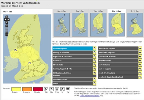
A yellow ‘be aware’ weather warning for storm force winds and ‘unusually high waves’ has been issued by the Met Office.
Gales, severe at times, are likely to affect North Wales, Northern England, Scotland and Northern Ireland from tomorrow night, during Wednesday and at first on Thursday with a risk of storm force winds for parts of Western and Northern Scotland.
The strongest winds will slowly ease on Thursday morning. Waves will be unusually high, bringing the risk of localised flooding of roads and causeways, particularly in western and northern Scotland and northern coasts of Northern Ireland.
Frequent wintry showers will also bring an additional hazard, mainly over higher ground. The public should be aware of the potential for disruption to travel and perhaps also power supplies.
60-80mph gusts
The Met Office chief forecaster said: ‘Very strong winds are likely to affect northern and central parts of the UK from Tuesday night until early Thursday as a deep low pressure system moves slowly eastwards between Scotland and Iceland.
‘There remains some uncertainty in the track and depth of this low and therefore in the exact wind strengths and timings, however a period of severe gales over the highlighted area is likely, as well as the potential for storm force winds over western and northern parts of Scotland.
‘Gusts of 60-70mph can be expected within the warning area, with 70-80mph in northwestern exposures.
‘Wintry showers could give some significant snow accumulations over high ground.’
Find more severe weather news stories here:
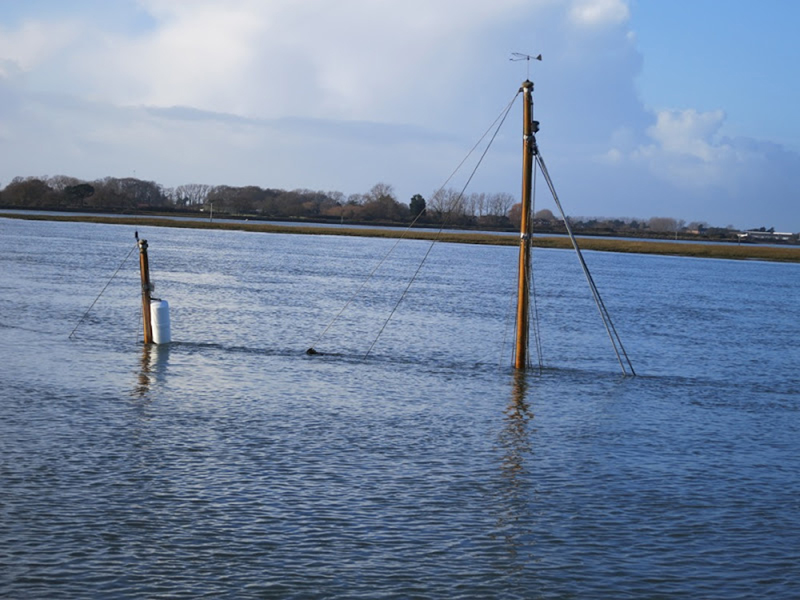
Yachtsmen warned of navigational hazards following storms
The latest in a string of violent storms has left a trail of navigational hazards around damaged coastal regions

Met Office issues ‘red warning of wind’ as storm strikes
Residents of north-west England and Wales are being urged to take safety action
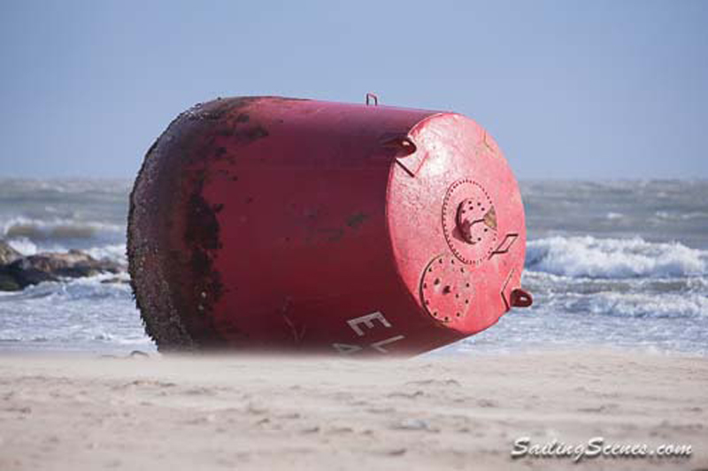
Large red buoy blown ashore by storms
Poole Harbour Commissioners are advising mariners to navigate with caution after two buoys are misplaced

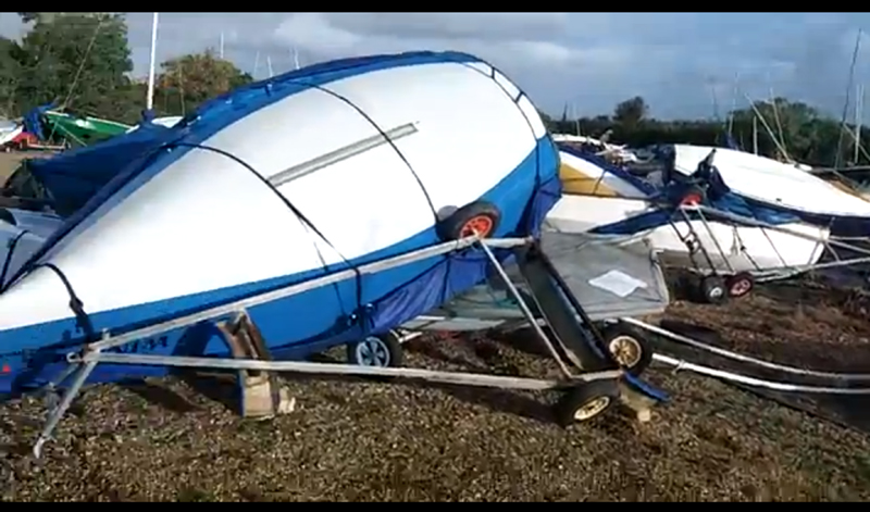
Surge in boat insurance claims following storms
Batten down the hatches - there's more extreme weather on its way!

Strong winds, rough seas and a storm surge
Weather warnings as an Atlantic storm brings a North Sea storm surge to parts of the UK

Storm rescues for boat owners
Three killed and houses, boats and cars damaged by St Jude's Storm
Warning to boat owners to secure vessels against storm
A major Atlantic storm is set to move across the UK over the next 24 hours

Storm-lashed solo sailor rescued
The yacht's sails were 'blown out' by severe weather conditions

Two sailors rescued after yacht drifts in storm
Early morning start for lifeboat volunteers in challenging conditions

RYA suspension for storm force 11 yacht owners
No more practical courses while under investigation
Leaving your boat in storms
Windy weekend - leave her safe and secure

Storms forecast – safeguard your vessel!
Insurers warn heavy rains can sink your boat