

A low pressure system, named Storm Imogen, has brought some very strong winds to southern England and South Wales as it moves eastwards across the UK today.
The Met Office has issued an amber “be prepared” national severe weather warning for wind for Storm Imogen which is valid until 6pm this evening. There is also a yellow “be aware” severe weather warning for wind.

Met Office chief forecaster, Will Lang, said: ‘Gusts of 60-70 mph are expected in southern England and parts of south Wales, with 80mph gusts possible in exposed coastal districts. Some very large waves are also likely along some coasts especially along the north coasts of Cornwall and Devon.’
Violent storm force 11 is expected in areas off the south coast of the UK with very high or phenomenal sea states in places, meaning wave heights could reach as high as 16 metres.
These are the wave heights expected out at sea, along the coast waves will be much smaller, for example the Bristol Channel could see waves of 4 to 6 metres with the highest waves expected at low tide, therefore reducing the potential impact on our coast. A maximum wave height of 19.14 metres was recorded 10.30am this morning at the Wave Hub off the coast of St Ives.
The strongest winds are expected to affect areas around the Bristol Channel and there is a risk of disruption to infrastructure, road, rail and ferry services.
Gary Webb from Highways England said: ‘We are keeping a close eye on the situation as it develops and would encourage drivers, especially those driving high sided vehicles, motorcycles or considering a trip with a caravan, to consider driving conditions before setting off as they could be difficult.
‘If you do have to make a journey by road be prepared, plan your journey in advance and check the latest weather conditions along your route.’
‘Be aware of sudden gusts of wind, and give high-sided vehicles, caravans, and motorbikes plenty of space. In the event of persistent high winds we may need to close bridges to traffic for a period, so please be alert for warnings of closures and follow signed diversion routes.’
 Surface Pressure Chart 8 February
Winds should gradually ease through Monday afternoon and evening. The Met Office says people should be prepared for disruption to travel as well as possible damage to trees and structures, and interruption of power supplies.
Tomorrow and Wednesday should be drier, quieter and colder days for many before more wind and rain follows later in the week.
Storm Imogen follows Storm Henry, which ran close to the north of Scotland at the start of February.

7 Storm Jibs on test
We test 7 storm jibs, including wrap around and sleeved sails, to find out the best options for your boat

‘Mary’ and ‘Barney’ among storm names chosen by the public
The Met Office and Met Eireann have announced the list of storm names chosen by the public for autumn and…

Storm surge breaches
One year on from the biggest UK storm surge for 60 years, new aerial photos have revealed details of breaches…
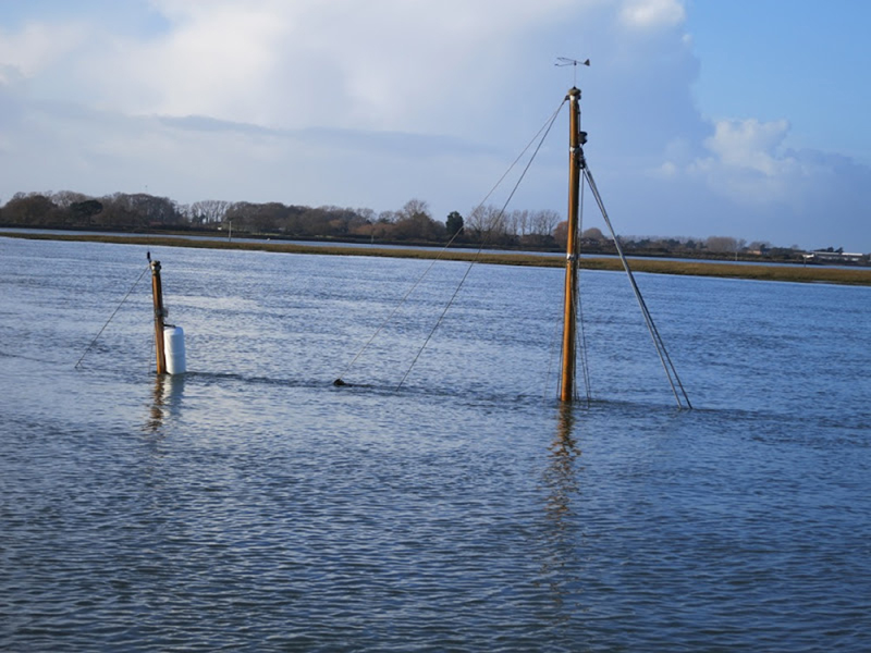
Yachtsmen warned of navigational hazards following storms
The latest in a string of violent storms has left a trail of navigational hazards around damaged coastal regions
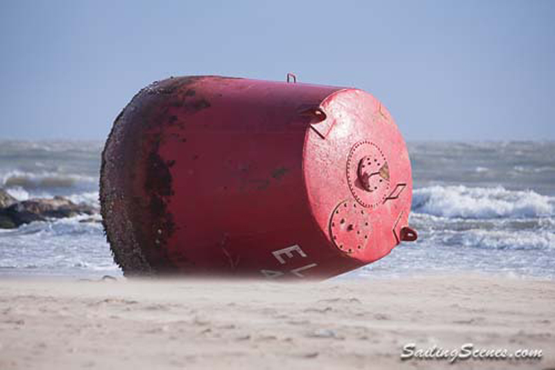
Large red buoy blown ashore by storms
Poole Harbour Commissioners are advising mariners to navigate with caution after two buoys are misplaced

Storm rescues for boat owners
Three killed and houses, boats and cars damaged by St Jude's Storm
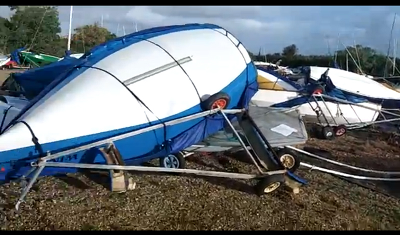
Warning to boat owners to secure vessels against storm
A major Atlantic storm is set to move across the UK over the next 24 hours

Storm-lashed solo sailor rescued
The yacht's sails were 'blown out' by severe weather conditions

Two sailors rescued after yacht drifts in storm
Early morning start for lifeboat volunteers in challenging conditions