
Has Navtex been superseded by smartphones and the internet, or does it still have a role in modern sailing?

The Navtex service (short for Navigational Text) is the primary method of disseminating Marine Safety Information (MSI) out to 270 miles and is part of the integrated Global Maritime Distress and Safety System (GMDSS). That’s all very well, but is Navtex, a 1970s technology from the days of link calls and Post Office shore stations, of any use to modern sailors? In these days of smartphones, good mobile data coverage and highly detailed GRIB files and weather websites, is it worth shelling out between £135 and £550 for something that will give you the shipping forecast, inshore waters forecasts and navigational warnings?
To answer that question, it’s worth examining exactly what Navtex gives you that mobile internet weather doesn’t. What it will do is store and display weather forecasts from a range of transmitters, in English, all over the world. It’s designed for reception at sea to between 250 and 400NM offshore, far beyond the usual range of VHF and a long way beyond mobile phone signal range. The GMDSS system is designed on the assumption that there are other ways of receiving safety information when in harbour or near the coast (VHF weather forecasts, etc).
Frequencies
International Navtex broadcasts all use a common frequency of 518kHz and are in English. National Navtex services usually use 490kHz. This may be received automatically on some dual-channel receivers but might have to be selected on others. Older sets usually only have the 518kHz channel. The UK uses 490kHz for inshore waters forecasts and weather reports. Most other countries use this frequency for national-language versions of their English-language 518kHz broadcasts.
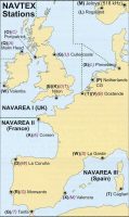
Each Navtex message has an area code (see map), denoting which transmitter it came from. You can generally tell the receiver which stations you want to receive and which to filter out, as a means of reducing useless and irrelevant information which would otherwise clutter up the receiver.
In addition, there is a secondary character which denotes the type of message (see the table at left). You can also filter these: some (navigational and weather warnings, for instance) cannot be filtered while others, like ice reports, can.
| character | Subject | |||||
| (Subject items in bold cannot be rejected by the receiver) | ||||||
| A | Navigational warnings | |||||
| B | Meteorological warnings | |||||
| C | Ice reports | |||||
| D | Search and rescue information | |||||
| E | Meteorological forecasts | |||||
| F | Pilot service messages | |||||
| G | Defunct in European waters, but used in other areas for DECCA messages | |||||
| H | LORAN (Long-range navigation) messages | |||||
| I | Available if required | |||||
| J | SATNAV messages | |||||
| K | Other electronic Navaid messages (messages concerning radio navigation systems) | |||||
| L | Subfacts/Gunfacts (UK use) – advisable not to reject this class of message in UK waters | |||||
| V | Amplifying navigational warnings initially announced under category A | |||||
What you get
Gale warning service plus twice-daily shipping forecasts on 518kHz. Each forecast bulletin includes a list of the areas for which gale warnings are in force, a general synopsis, and forecasts for each sea area (areas being grouped when convenient). Amendments to the forecasts between the routine issues are via the gale warning service.
For those sailing within 12 miles of the coast, the National Navtex service on 490kHz provides the relevant text of the inshore waters forecast. This includes a 24-hour forecast and a 24-hour outlook for each inshore area plus a general outlook for all UK inshore waters for the following three days. This forecast service on the UK National Navtex service on 490kHz also includes Strong Wind warnings (those issued for expected winds of Force 6 or more in the coastal strip extending to five miles offshore). Navtex receivers will store all received messages, even those which you have elected to filter out.
How useful is Navtex?
Coastal sailing
The specification for Navtex shows that it’s designed to operate at sea, and that other forecasts are available inshore (mainly via VHF). However, many people report that
it works in harbour, and appreciate that a forecast will be waiting for them when they wake up in the morning. Most coastal areas have good VHF reception, and, increasingly, good mobile data coverage, so on the face of it you’re unlikely to need Navtex for weather forecasts. In some areas, where mobile data is sparse, such as the west coast of Scotland, there is a stronger argument for Navtex – but where mobile data is available, the forecasts on sites such as WindGuru are far more comprehensive, detailed and useful than
the vague shipping forecast.
A further drawback for day-sailors is that it’s not on-demand like internet weather – rather, the Navtex needs to be left on to receive messages as transmitted. That’s fine on a cruise when the power will be on constantly, but for weekend sailors it’s less useful.
Where Navtex is arguably more useful is for receiving navigational warnings, Gunfacts and Subfacts, which can often be missed when listening to a VHF radio broadcast. Having these in a printed form can be really useful.
Offshore sailing
Offshore sailing is where Navtex comes into its own, and is what it’s designed for. There are limitations – and if you have a satellite phone, GRIB files downloaded via satellite network are increasingly cheap and give a more detailed forecast than that available over Navtex. Without a satphone, Navtex is likely to be your primary source of weather data offshore and thus invaluable.
Foreign cruising
518kHz broadcasts are in English throughout the world – which is extremely useful when sailing in a foreign country where the language is a bit of a mystery. However, mobile data is now relatively cheap when roaming, especially when signed up to an agreement such as Vodafone Passport.
Local SIM cards can be bought to give you cheaper data longer-term, so internet weather information is becoming more readily available.
What’s available
We last tested Navtex receivers in PBO April 2005. Here’s what’s currently available.
NASA Marine Target Navtex Pro-Plus v2

PRICE: £247
Contact: NASA marine
ICS Nav6 Navtex

PRICE: £549.95
Contact: ICS
Easy Navtex

PRICE: £285
Contact: NASA Marine
PC Navtex USB
(PC required)
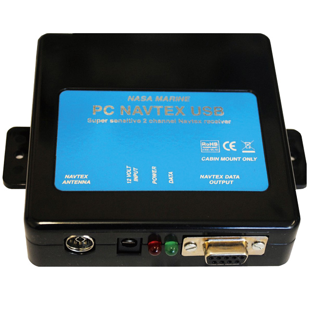
PRICE: £135
Contact: NASA Marine
Mörer Weather InfoBox Handheld Navtex receiver

PRICE: £359.95
Contact: www.weatherinfobox.com
Furuno Navtex NX-300

PRICE: £524.95
Contact: www.furuno.com
PBO Verdict
So, has Navtex had its day? If you already have it on your boat, it’s still useful – but should you shell out up to £550 on a receiver if you don’t?
That depends on the type of sailing you’ll be doing. I’d argue that if you can get a reliable mobile data connection, you’d be better spending your money on that. Internet weather is now so accurate that it runs rings around the forecasts transmitted over Navtex.
However, for offshore sailing and extended coastal cruising, especially in foreign countries, having a dedicated receiver to give you regular forecasts and navigational warnings is potentially invaluable. It’s a shame that no one has yet made a Navtex receiver that can store data ready to be displayed on demand via a chart plotter or smartphone, as this would help reduce the number of displays to clutter up the chart table.

A handy guide to using traditional skills for navigation
PBO contributor Sticky Stapylton shows how to work out an estimated position and course to steer
New Irish Navtex broadcast for West Scotland
Malin Head, Eire station begins transmission 1 April
Jester Challenge: One sailor’s preparations for a solo adventure
Two-time solo Atlantic racer Basil Panakis shows PBO’s Ben Meakins how he prepared his 25ft yacht to face the Jester…

Nav in a nutshell: Making comfortable progress to windward
Why make heavy going in choppy conditions when a less demanding alternative heading will get you to your destination in…
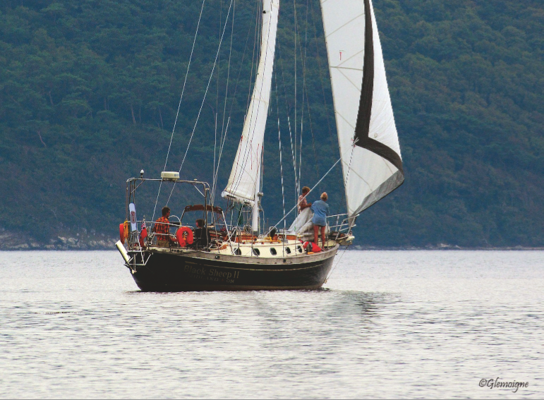
Golden Globe race: Refitting Black Sheep
In 1968, the original Golden Globe Race was widely regarded as ‘a voyage for madmen’. But where does that leave…

Nav in a nutshell: Lee bowing defined
Dick Everitt explains how you can get a little lift from the tide

Nav in a nutshell: How to use a Breton Plotter
Breton Plotters are simple to use in practice, but tricky to explain on paper – it’s much easier if you…
14 iPad and Android navigation apps tested
Gear test following an explosion in the number of marine navigation apps available for iPad and Android devices in the…

2018 Golden Globe Race – more details announced
"Interest in this retro race has struck a chord with so many sailors around the world," says 2018 Golden Globe…

12 diesel bug treatments tested
Diesel bug can clog filters and starve your boat engine of fuel just when you need it most. Can diesel…

Nav in a nutshell: Tacking to clear a headland
Simple step-by-step chartwork can show us when we’ll need to tack to clear a headland, says Dick Everitt.
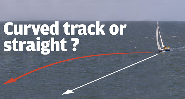
Nav in a nutshell: Curved track or straight?
GPS will keep us on the straight and narrow by constantly showing how much we need to adjust our heading…