
Owen Moorhouse recalls a cruise along the coast of New South Wales and reflects on the history and landmarks of his home waters
Well known for beautiful beaches and rugged sandstone vistas, the coast of New South Wales makes for some magnificent sailing.
I’ve been cruising it for decades and it’s always an invigorating challenge that takes some planning for there are few safe harbours along the way.
The coast is exposed to the Tasman Sea and the coastal winds are notoriously inconsistent, ranging from thrilling to frustrating and, on occasion, downright frightening.
Article continues below…

How to sail to Australia from the UK in a small boat
Kate and Jonny Harrison dreamed of a round-the-world backpacking tour to Australia – but then their plans took a nautical

New Zealand to Fiji on a 26-footer – learning from experience
Euan Crawford experienced mixed fortunes when he and his girlfriend sailed their uninsured, un-surveyed, 30-year-old Raven 26 from New Zealand…
With no prevailing winds to rely on, yachtsmen are often at the mercy of complex currents and sudden weather events, including the abrupt southerly change fondly known in the Australian vernacular as a ‘southerly buster’.
There are also ferocious weather events called East Coast Lows – intense low pressure systems that form off the coast.
But sometimes you get lucky, as I did on this solo voyage.

Time to contemplate
In late summer, I sailed south from Newcastle to Jervis Bay in conditions so perfect that I had time to sit back and contemplate 200 years of history of each lighthouse along the way.
Mooring to mooring it was a journey of 160 miles.
With a predictable summer north-easterly breeze on the aft quarter, I set sail in Sandpiper, my 38ft Robert’s sloop, but as expected the breeze faded at sunset.
I was still about 16 miles north of Sydney Harbour when the wind threatened to becalm me near the Three Headlands, at the entrance to Broken Bay.

Owen Moorhouse aboard Sandpiper
Fortuitously, this stunning bay is the confluence of three waterways: Brisbane Water, the Hawkesbury River estuary and Pittwater, offering some of the best boating opportunities along the entire coast.
On a gentle beam reach and making tide there was still enough puff to carry me a further two miles inside the heads and onto Refuge Bay.
Protected by steep sandstone cliffs, Refuge Bay boasts a deep-water anchorage that extends to the rocky foreshore.
It has been a refuge for mariners since colonial times.
Uninhabited haven Embraced by beautiful Ku-Ring-Gai Chase National Park, Refuge Bay remains completely uninhabited.
At the southern end there’s a sandy beach and small waterfall.
Little wonder that sailors have anchored here for more than 200 years!
Intriguing carving

The name ‘Olive’ carved into the rock at Refuge Bay
There is also history in the big rock at the beach, where 100 years ago a bored crewman carved the word ‘Olive’ into the sandstone.
I’m not sure whether it was the name of his ship or his sweetheart.
I rested for a day under the cliffs at Refuge Bay and paid my respects to the men at the wartime memorial plaque, but with favourable weather predicted I was soon retracing my course.
I set off towards Barrenjoey Lighthouse – the first of eight lighthouses that punctuate the coast south to Jervis Bay.
Barrenjoey Light stands on a rocky hill at the southern headland of Broken Bay.
The sandstone used to build it was quarried directly from the site back in 1881, when signal lanterns replaced the old brazier lamps.
The new light would have been a welcome sight, particularly for boats that plied the waterways to Sydney back when food supplies came mainly from the alluvial plains of the Hawkesbury River, inside Broken Bay.

Small beach and sandstone cliffs at Refuge Bay
South Head
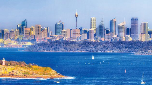
Once again, the reliable north-easterly breeze filled the main and genoa to carry me 16 miles towards Sydney’s South Head, marked by the iconic Macquarie Lighthouse.
There has been a navigational aid on this headland since 1791, making it Australia’s oldest and longest serving light.
The current heritage-listed building was built 90 years later and completed in 1883.
But just 1.5 miles north of here, on the headland at Lady Jane Beach, is another small lighthouse with distinctive vertical red stripes.
Commissioned in 1858, Hornby Light was the second lighthouse built in New South Wales and marks the most northerly point of South Head.

Hornby Lighthouse. Credit: Annalucia/Alamy
Its construction was the result of an inquiry into Australia’s worst maritime disaster.
On 26 August 1857, the Dunbar sailing ship was 81 days out of Plymouth when 121 lives were lost on Sydney’s doorstep.
Just one crewman survived.
Until then, the entrance to Sydney Harbour was obscured to ships on approach from the south.
Caught in a violent east-coast low, the captain mistook a feature in the cliffs known locally as The Gap for the entrance to the harbour and drove his fateful ship onto the rocks.
The increasing north-easterly wind filled my sails and coupled with the southerly set of currents, I sailed on past these two lights.
It wasn’t long before I was checking off my fourth lighthouse of the day at Cape Baily.
I can even remember when this unremarkable lighthouse was built, for it was commissioned in 1950 and stands on the northern approach to the historic Botany Bay.
Now a busy working port, Botany Bay replaced Sydney’s Port Jackson in importance, when container ship traffic increased and air and sea cargo was centralised there.
Two runways for Sydney’s International Airport now protrude into the bay and Kurnell oil refinery defines the southern shore.
The bay is still popular for watersports but is a far cry from the days when Captain Cook first dropped anchor in 1770.
Governor Arthur Phillips was next to arrive in January 1788 with the First Fleet but he soon deferred to the merits of Sydney Harbour to establish the first British penal colony.

Hornby Light is on the most northerly point of South Head. Credit: David Wall/Alamy
Voyages of discovery
The First Fleet arrived just eight days ahead of the French navigator La Perouse, who also anchored in Botany Bay during his scientific voyage of discovery.
Contrary to popular acclaim, La Perouse was under no orders to claim Terra Australis for France, but had limped into the bay after 12 of his crew were killed in Samoa.
After six weeks of repairs and recuperation, La Perouse set sail never to be seen again, for the expedition was soon lost to a cyclone in the Solomon Islands.
I have anchored in Botany Bay on a few occasions, but as the wind was still fresh, I held my course along the beautiful, cliff-lined coast that stretches south towards Wollongong.
It’s here where the sandstone cliffs of the Royal National Park and the coal-rich escarpment plunge dramatically into the sea.
Somewhat apprehensively, I planned to spend the night in Wollongong’s Belmore Basin, some 39 miles further south.
I’d pulled in there on several occasions, so was well aware that the only moorings available are often rafted up alongside a well-fendered boat.
Not only is the swell unforgiving, but I’d been woken in the small hours by the fishermen wanting to leave port.
Yet Belmore Basin is full of character and history.
In 1837, 300 convicts crushed rock behind a cofferdam in an admirable feat to construct the harbour.
The 100ft x3 5ft sandstone basin was significantly enlarged in 1841 when more excavated rock was used to build the sea walls.
The construction took three years but the harbour entrance remained dangerously shallow at low tide.
Further extensions were made over the years and today it forms part of Wollongong’s beautiful harbour precinct and is crowded with fishing boats and pleasure craft.
It’s also the only place in Eastern Australia with two lighthouses in very close proximity.
The original Wollongong Head Lighthouse at the end of the breakwater was constructed in 1871, using prefabricated cast iron plates, but it is not visible from sea.
I was just a kid when Flagstaff Point Lighthouse replaced Wollongong Light in 1936.
It was the first new lighthouse built in New South Wales for over 30 years and the first with fully automatic flashing lights.

The commercial docks of Port Kembla, NSW. Credit: Harley Kingston/Alamy
By this time, Belmore Basin had ceased to be the coal port for Wollongong having been usurped by the industrial city of Port Kembla, some 3 miles further south.
The sun sank as I passed Wollongong but fortunately this time the wind retained its strength.
I wasn’t keen to tackle Belmore Basin in the fading light, so decided to sail on by.
Sandpiper has two steering positions: a conventional ship’s wheel in the wheelhouse and a tiller in the cockpit; both connected hydraulically.
An Autohelm 2000 is attached to the tiller and powered with a 12V battery.
A gybe is always possible with a following wind, so I maintain a steering watch only using the Autohelm when I need to leave the cockpit, for demand on the batteries is higher at night.

The lighthouse on Barrenjoey headland. Credit: Wirestock/Alamy
Commercial shipping
As a single-hander, I’m also aware of the importance of maintaining motor starting-power should I ever need it urgently, especially in the busy commercial shipping lanes like those near Port Kembla.
Nowadays, it’s a designated ‘First Port of Entry’ but there are no facilities for recreational boats.
The port handles mammoth bulk carriers around the clock, all of which are cause for extra caution when sailing north or south.
I inhaled the fresh sea air and felt exhilarated, for the night was warm and the breeze steady on the port quarter.
For once, everything seemed to be coming together: the wind, the sea, the currents and the balmy weather, so I sailed on towards the tiny port of Kiama, just 15 miles further south.

Kiama lighthouse at Blowhole Point. Credit: Richard Milnes/Alamy
I kept Kiama Lighthouse in view to guide me clear of the Five Islands near Port Kembla, as all are unlit.
Kiama too has a manmade harbour that dates from the convict era.
The basin was built to load locally quarried basalt, when road and railway construction boomed in the 19th century.
Robertson Basin was opened in 1876 and 10 years later, Kiama Lighthouse was inaugurated.
It is far more visible than the lighthouse at Wollongong, which tends to merge into a haze of urban lights.

Wollongong Harbour and lighthouses. Credit: David Paul/Alamy
Kiama is a charming little town that derives its name from the Aboriginal term for ‘where the sea makes a noise’, for the lighthouse stands above the spectacular Kiama Blowhole.
I have previously entered Robertson Basin in both southerly and nor-easterly winds.
Quaint as it is, the waves and swell encountered in most conditions can be a little hair-raising and Robertson Basin is definitely no safe haven in rough weather.
In the dark of the night, I quickly decided to give it a miss.
By now, I was soaking up the joys of a near perfect sail and was only 28 miles from Jervis Bay with two more lighthouses to identify.

Old and new lights on Point Perpendicular, seen across Jervis Bay. Credit: Genevieve Vallee/Alamy

Two bridges over the Shoalhaven River: the one on the right is from 1880s. Credit: Genevieve Vallee/Alamy
The light at Crookhaven Heads marks the entrance to the mouth of the Shoalhaven River, accessed via a canal dug in 1822.
The area’s original landholder, Alexander Berry, directed its construction following the loss of a seaman at the Shoalhaven bar.
Berry’s Canal connects the adjacent Crookhaven River to the Shoalhaven, to provide a less hazardous entry.
Using no more than shovels and a wheelbarrow, it was dug by two convicts and became Australia’s first man-made, navigable canal.
Over time, the river flow and erosion dug the rest.
In 1882, a wooden lighthouse was constructed to replace the lanterns placed on poles by local boatmen and I am forever grateful for it.
For Crookhaven Heads Light also marks the southern end of the Shoalhaven Bight and guides me past a series of reefs known as Sir John Young Banks.
Previous experience has taught me to give The Banks a wide berth, as they rise steeply to a shallow 16m and literally stand up when the southern current pours over them.

Macquarie lighthouse on Sydney Harbour’s South Head. Credit: Taras Vyshnya/Alamy
Where’s that light?
By now, I’d decided to make a run for Jervis Bay and The Banks were all that stood between me and my final destination, so I winched in the main to give me a course to stay well clear.
I had expected an early sighting of the last lighthouse at the entrance to Jervis Bay but was puzzled when nothing appeared.
I deferred to my chart and GPS to confirm my course before a beam from Point Perpendicular Lighthouse eventually appeared.
By then, I was already rounding the massive cliffs below the light and wondered why I’d not seen that familiar and reassuring beam.
I’m still at a loss to understand why the old light was replaced in 1993 by a bright quartz halogen light atop an unedifying skeletal tower.
I was convinced it was less visible on approach from the north and it certainly commands nothing of the majesty of the classical lighthouse, which was built in 1899 of pre-cast concrete blocks and daubed in white paint.

Point Perpendicular’s old light. Credit: Genevieve Vallee / Alamy Stock Photo
I’d arrived at my ultimate destination – Jervis Bay – one of the deepest, sheltered harbours in Australia.
With its wide, all-weather entry, it is a bay of dazzling natural beauty.
On the southern side, Bowen Island provides easy shelter from easterly winds but I skirted it, to head to a favourite hideaway called Hole in the Wall.
This beautiful sandy cove is not only protected from the southerly and easterly winds, but has a sparkling white beach and small creek for fresh water supplies.
It was the dead of night and I was feeling the full effects of a very long day.

Cape Baily lighthouse. Credit: Richard Milnes/Alamy
As I approached Hole in the Wall I turned on the engine, furled the sails and advanced as close as I dared to the shore.
With one eye on the depth sounder and the other in the beam of my handheld searchlight, I drew closer to the beach, confident in the knowledge there were three public moorings nearby.
Yet none appeared from the darkness.
I was tired and contemplated setting the anchor, even though I knew this was discouraged to protect the sea grass.
I sighed in frustration when suddenly a buoy bobbed along the starboard side.
It was with a weary sense of good fortune and relief that I slowly pulled it on board.
The following morning I woke to find I had the entire pristine bay to myself.
Calm waters gently lapped the hull as I settled in the cockpit for coffee, feeling refreshed and proud of my new personal best.
Mooring to mooring, I had averaged almost 7 knots, passing 8 lighthouses in 18 hours.
Not bad for an Old Salt!
MV Krait and Z Special Unit

A captured Japanese fishing boat was renamed MV Krait
Refuge Bay also harbours a unique slice of wartime history.
For it was from a secret camp high on the cliffs that men of Z Special Unit underwent commando-style training for a daring raid on Singapore Harbour during World War II.
Led by Major Ivan Lyon of the Gordon Highlanders and Major Jock Campbell of the King’s Own Scottish Borderers, 11 Australian and five British men were selected for Operation Jaywick.
They sailed a captured Japanese fishing boat from Refuge Bay all the way to the Singapore Straits, some 4,800 miles away.
Disguised as Malay fishermen, they anchored MV Krait off the island of Pulau Panjang and from there launched two-man collapsible canoes and paddled more than 20km through darkness into the heart of enemy territory.
In Singapore Harbour they attached delayed action limpet mines that resulted in the sinking of seven Japanese ships.
It is considered one of the most daring and successful seaborne raids in military history.
The MV Krait and all the men returned safely, and the boat is now in the Sydney Maritime Museum.

Plaque commemorates wartime action
A brief history of Jervis Bay
On St George’s Day 1770, Lieutenant James Cook simply noted the entrance to Jervis Bay, as he sailed past in HMS Endeavour.
Lieutenant Bowen was first to enter in 1791, as captain of the convict transport Atlantic that was sorely in need of repairs.
He named the bay Port Jervis after Admiral John Jervis, under whom he had served.
Several early French navigators visited in the years soon after, including Nicolas Baudin and Jacques Hamelin (1801), Louis de Freycinet (1819) and Jules Dumont d’Urville (1826), who made friendly contact with the local aborigines while sheltering in the bay.
During the 19th century, international whalers frequently stopped by and it soon became a busy export hub for wool.

Admiral John Jervis is best known for his victory at the 1797 Battle of Cape Saint Vincent. Credit: Timewatch Images/Alamy
In 1864, the first of many shipbuilding yards sprung around the inlet at Currambene Creek that was the terminus for the historic convict-built Wool Road.
The very first lighthouse was built in 1860 at the southern entrance to Jervis Bay, but a fundamental error meant it was not visible on approach from the north.
Between 1864 and 1893, 23 ships were wrecked in the vicinity of Jervis Bay, so in 1899 Point Perpendicular light replaced the one at Cape St George.
Investigators had discovered this lighthouse had been negligently built some 4km from the intended site, because it was closer to the quarry for the stone.
To avoid confusion, the original lighthouse was reduced to rubble by naval firepower in 1917, but the ruins still remain.

Old lighthouse ruins at National Park in Jervis Bay. Credit: Rodney Ndaira/Alamy
Then, with the establishment of the city of Canberra in 1901, a port for the new landlocked national capital was identified at Jervis Bay, 200km away.
In 1915, a 75km2 section of land at the bay’s southern end was surrendered by New South Wales to the Commonwealth of Australia.
The Royal Australian Naval College, HMAS Creswell, was established there and today the area remains Australian Capital Territory even though grand plans to connect the railway and build a port never materialised.
That said, in 1920 Edward Prince of Wales added prominence when he visited Jervis Bay on board HMS Renown, and during World War II the bay became an assembly point for troop convoys destined for the Middle East.
Capital ships like RMS Queen Mary I, along with other pre-war passenger liners-cum-troop ships anchored there preparing to head for Alexandria in Egypt.
Why not subscribe today?
This feature appeared in the December 2021 edition of Practical Boat Owner. For more articles like this, including DIY, money-saving advice, great boat projects, expert tips and ways to improve your boat’s performance, take out a magazine subscription to Britain’s best-selling boating magazine.
Subscribe, or make a gift for someone else, and you’ll always save at least 30% compared to newsstand prices.
See the latest PBO subscription deals on magazinesdirect.com