
David Sloan discovers the simple navigational error that turned his parents’ Channel hop into a near disaster
In June 1962 I very nearly lost both my parents.
They were returning to our home port of Weymouth after a short cruise along the north Brittany coast in our boat Priscilla – a 29ft Bermudan sloop, designed by Norman Dallimore and built by Harry King at Pin Mill in 1932.
I was 16 at the time and the story made little impression then, but over the years it has nagged away at me.
I have now combined contemporary sources of tidal and weather information with my father’s log entries, mostly written up the following day, to piece together how they came so perilously close to disaster off Portland Bill.

David Sloan’s parents, Robbie and Aileen Sloan, with his younger brother Nick, around 1962
A frightening passage
They left the town of Tréguier at 0730 on 19 June in sunshine, with good visibility and a friendly Force 4 south-westerly, intending to spend the night in St Peter Port before returning home the next day.
They piloted their way out of the Tréguier River out to Basse Crublent, where they set a course for Guernsey, 40 miles away.
They watched Les Heaux lighthouse disappear over their starboard quarter but then the mist thickened and visibility worsened. The 60m-high Roches Douvres lighthouse never showed itself.
As the day wore on and the wind freshened, the lack of landfall caused them increasing concern.
Around 1800 they saw light glinting off glasshouses on what must have been Guernsey. But it was some way off. A bearing of 140°M put them well to north of their intended track.
Rather than face a tricky windward return and arrival at St Peter Port in the dark, they decided to crack on to Weymouth.
The course set for Shambles (then a lightship), however, depended on a guess as to where they were starting from – somewhere north-west of Guernsey.

Priscilla photographed in 1958

Casquets Lighthouse off Alderney, Channel Islands. Credit: Stephen Dorey Creative/Alamy
As it got dark the Casquets light showed up for a while and at about 0300 they saw briefly the four white flashes of the Portland Bill light on their starboard bow, but no bearing is recorded.
So they altered course and travelled on 090°M for two hours before coming back to 020°M.
By 0500 visibility was very poor, with frequent squalls. They were over-canvassed as they had lost overboard the handle of the worm roller reefing gear.
It’s unclear whether they were ever able to take in more sail but: ‘We towed 15 fathoms of 2in hemp in a bight astern, which did reduce our speed and made steering easier.’
As time passed the murk thickened and they reported passing through confused seas. Just after noon they sighted cliffs, which they hoped were at Ringstead, 5 miles east of Weymouth.
But as they got closer, to their horror, they found themselves looking into the jaws of West Bay harbour, 16 miles north-west of Portland Bill.
The weather report from the Met Office Air Ministry observation station at Portland Bill for 20 June reads: ‘Gale force winds at first with rain, later drizzle. Wind fresh to strong, sometimes gale force all day’.
After 30 hours at sea and a miserable wet and windy night, finding themselves 20 miles away from their expected location and with one of the world’s most notorious navigational hazards between them and a warm bed, one can only imagine how scared and exhausted they must have felt.
With the strong onshore wind it would have been reckless to attempt the entrance to West Bay.
It had no sheltering arm of a breakwater then as it does now and in my father’s words ‘we could see the south-westerly swell surging along the narrow gut between the piers’.
Their choices were to head 34 miles west to Brixham into the teeth of the wind, round Portland Bill through the close inshore passage or back round Portland Race and the Shambles Bank. They chose the latter.
At about 1300 they set off for the long haul round the outside of the Race. The course set, 160°M for three hours, then 140°M for two hours, before heading back north, on first glance looks reasonable.
My father was always sick at sea and I can imagine him hating having to go below to plot a course. He does not mention how he calculated tidal set and drift. But at least they now had a starting point.
Throughout the afternoon they were: ‘again travelling through a very confused sea and steering was very tiring.’
At about 1830 they gybed onto a course of 014°M and at about 1915: ‘were relieved to hear the Shambles foghorn’ which got louder then disappeared.
They assumed they were approaching the eastern shoreline of Portland. They continued, heading north-west.
The sky cleared a little and revealed a clear horizon to the west. In some panic they decided to head east again and were horrified to see Portland Bill lighthouse dead ahead, at about 1945.
At this point: ‘There was soon no question of going back. We were swept towards the Bill with the long south-westerly surge lifting us bodily towards it, and the sight of seas breaking heavily on the Pulpit Rock was hardly reassuring. Our noble engine never faltered and we went round the point like a shot from a gun at a horrifying speed. Strong whirling undertows made steering very difficult. As we rounded the point we had a brief accidental gybe but managed to get the boom over before gybing again deliberately so as to lie close under the land towards Grove Point.’
That they had the good sense to tuck into the eastern shore of Portland to prevent being pushed out into the Race was vital. The turmoil died down and they reached their Weymouth mooring by 2100, nearly 38 hours after leaving Tréguier, exhausted and chastened but relieved.

Priscilla’s passage from Tréguier to West Bay and on to Weymouth
How did it go so wrong?
The basic principles of navigation were the same in 1962 as they are now: know where you have started from and when, choose your course, take account of tidal and other variables, keep checking that you are on track and avoid hazards.
However the navigational kit was very different. My parents had a steering compass, a hand-bearing compass, a Walker’s patent log, which was streamed astern on a line to give an approximate distance travelled and speed through the water, a lead-line, Radio Direction Finder (RDF), long wave radio receiver and charts.
The RDF was a crude device. It involved turning a ring aerial until you got a null signal from a known transmitter. In heavy seas, it was difficult to use, told nothing of distance and gave a bearing of doubtful accuracy.
Today, as long as we have a GPS signal, checking we are on track is easy. In 1962 position fixing was primarily by visual or radio bearings, or both.
Over longer stretches with few visual clues, position had to be estimated. To do this accurately required knowing your starting point, distance travelled, on what bearing over what time and speed and then adjusting for tidal and other variables.
Magnetic variation we can almost ignore these days but in 1962 off the south coast it was a whopping 8° W. That combined with compass deviation, up to 6° for Priscilla, could make a major difference to the estimated position.
So navigation relied heavily on the meticulous recording of all available clues. Any inaccuracies or omissions would amplify error and lead to a wildly inaccurate estimate of position, which turned out to be the case here, after 30 hours at sea.

Portland Bill in Dorset on a moderately good day. Credit: David Noton Photography /Alamy
My father admits, in his account, to errors of omission. There were also some serious mistakes.
Their first error was not to fix their position before visibility fell after they left Tréguier.
They had a good view of Les Heaux and a radio bearing from the transmitter at Roches Douvres. Not a brilliant fix but better than nothing.
They also failed to stream the log so could only guess at speed and distance travelled.
Thereafter, they had little visually to go on, just the indefinite Guernsey shoreline, then Casquets light.
It is possible that they could have got a running fix on Casquets but it is unclear how long the light was visible.
When they briefly saw the Portland light at 0300 they turned east for two hours but didn’t check the tides.
In fact, in the two hours they travelled east the big spring tide set them back about 4.6 miles west.
They turned north but the tide continued to take them west for the next two hours.
From an uncertain starting position it is not surprising to find them way off course by the time they made landfall at West Bay.
More puzzling was how they got it so wrong when they tried to pass outside the Race and Shambles.
Again they failed to stream the log. Their estimated 5-knot speed, in heavy seas, was likely to be overestimated.
But when I tried to plot their course steered, correcting for variation and leeway I still couldn’t get them back to the west of Portland Bill
Until I realised that, from the comfort of my kitchen table, I too was making a mistake; I was plotting tidal set using Dover as the reference port, plotting on a 1964 Admiralty chart, corrected to 1971 – 2454 Prawle Point to Hengistbury Head, probably very similar to the one they used.
This has tidal diamonds based on high water Devonport (Plymouth), not Dover.
If I slow them to 3.75 knots and plot using HW Devonport they end up, just as they did in reality, just west of the Bill.
I suspect this is what my father had done, sitting uncomfortably at Priscilla’s chart table.
His understandable mistake was very nearly fatal. During those five hours travelling south-east, the tide took them more than 10 miles back west.
The recommended route round the Bill is to make landfall about a mile to the north of the tip and then come down the western shore of Portland keeping close in.
They approached from the south so it is possible that they had passed through the edge of the Race. Much larger ships have come to grief in this turbulent spot.
The irony is that had my parents made directly for the inshore Portland Bill passage from West Bay, they would probably have arrived at the right time to round the Bill from west to east, at slack water, which is at Dover HW +4½ hours (Devonport HW -2¼) instead of when they did, at Dover HW +6 by which time the stream would have been running at 5 knots or more and must have been very frightening indeed with a big sea running.

The pretty town of Tréguier, Cotes d’Armor, France. Credit: Hemis/Alamy
Lessons learned
The first lesson is about navigation; doing it properly and thoroughly and leaving as little as possible to guesswork. The second is about human behaviour and endurance.
My father’s omissions in not fixing a starting position, nor streaming the log at two crucial times were serious.
It meant that when they lost visibility they could not plot an estimated position with any accuracy.
They had to hope that they were on track and that new visual clues would emerge – but they didn’t. Getting the tidal calculations wrong by misreading the chart led to a near fatal outcome.

Hand-bearing compass; no power required. Credit: Roger Ashford/Alamy
Could these errors happen today?
We can all still misinterpret charts, electronic or otherwise but GPS allows us constantly to know where we are and tells us if we are off track. Our chartplotter will even alarm if our cross track error is too great.
But what if, mid-passage, you had a power failure or GPS went down? Are you confident navigating without electronic aids?
In contrast to the massive changes in electronic aids to navigation since 1962, the demands that being at sea makes on us as human beings have changed little.
Clothing has improved, managing sails is generally easier but sailing, especially in harsh conditions is still physically and mentally hard.
When my parents set out from Tréguier they were perhaps too relaxed. They failed to fix their position before the mist arrived.
They became anxious as they failed to find Guernsey, had a horrible night and arrived off West Bay in no condition to make difficult decisions.
One mistake compounded the next so that in the end they just had to carry on but in retrospect I wonder if, the previous evening, they would have been better off returning to Guernsey for the night.
Trying to attempt too much is something which can happen today despite, or even because of, our electronic aids.
I am very grateful that my parents returned safely that June.
We owned Priscilla for another couple years but I don’t think the fear engendered by those 38 hours ever really went away and my parents took up golf instead!
Priscilla however is still going strong, having been lovingly restored by her present owners, Nico Dekker and Elyn Nierop.

Priscilla is a 29ft Bermudan sloop built in 1932

Priscilla today after an extensive renovation

David Sloan
About the author
David Sloan took part in his first sailing race propped in the bows of a Weymouth Falcon aged six months. A retired doctor, David has sailed on and off all his life and owned various boats. Currently he sails a Beneteau First 26 out of North Fambridge on the River Crouch.
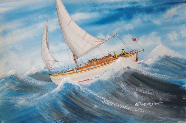
As published in the April 2019 issue of Practical Boat Owner magazine. Send us your boating experience story and if it’s published you’ll receive the original Dick Everitt-signed watercolour which is printed with the article. Email pbo@ti-media.com