
PBO reader Peter Gaskin has a problem with his Raymarine RL70C chartplotter. Our electronics expert suggests a possible solution…
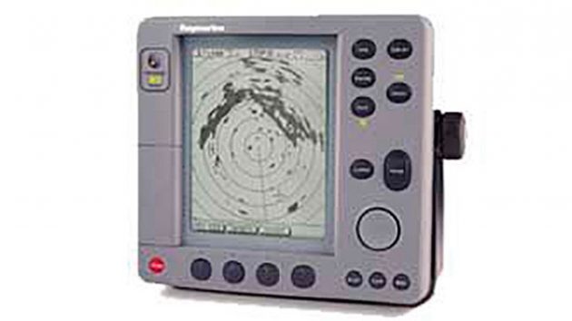
Peter Gaskin writes: “I have a problem with the Raymarine RL70C plotter on the boat – it won’t show below three miles range.
“We suspected the card and got a replacement on eBay which failed to solve the problem: it is a fairly old model to be fair, and we haven’t found a more reliable supplier for a card.
“However, rather than the card itself I’m now wondering if it might be hardware or software trouble?”
Article continues below…

Best chartplotters: new MFDs that every boat owner should consider
One of the best ways to choose new marine electronics is to get your hands on kit from a range…

Nav equipment and electronics: how to set up your boat on a budget
Marine electronics have come a long way since the days when a log, depth sounder, VHF and GPS, or even…
Electronics expert Andy Haines replies: “It sounds like you might have the Raymarine RL70C’s ‘Plotter Mode’ turned on.
“This is a feature which is aimed primarily at the fishing market, where you aren’t actually interested in the cartography, merely plotting where you are going in relation to where you were (say 30 seconds or 1 minute ago).
“It’s ideal for drifting over wrecks: with the plotter mode on all you have is your track; if you catch fish, you go back and try to drift exactly the same track again.
“If you don’t catch, you try drifting a few metres away and so on – the point being you are only interested in your track relative to a particular point, not actually where that point is in the wider scheme of things.
“However, obviously you will have needed to know where to start drifting, so using the plotter in ‘Normal’ mode would take you to that waypoint or ‘mark’ in the first place – Plotter Mode would be for drifting the mark.
“So you need to turn ‘Plotter Mode’ off. Press ‘Menu’, then press the soft key at the bottom ‘Chart Set Up’. A full screen of choices then comes up, second one down is ‘Plotter Mode’. It will say ‘on’ or ‘off’, use the soft key at the bottom to turn it off. I’m almost certain this will be the problem.
“Interestingly, Plotter Mode comes in to play at different ranges depending where you are. In your case it won’t zoom under 3 miles: this means you were several miles offshore, whereas if you were, say, in the Solent, the chart would have zoomed down to 1.5 miles, but not below that.
“In a harbour or river it may zoom down to say ¾ miles – it varies depending on what the zoom value is at that particular point on the chart.”
Why not subscribe today?
This feature appeared in the April 2022 edition of Practical Boat Owner. For more articles like this, including DIY, money-saving advice, great boat projects, expert tips and ways to improve your boat’s performance, take out a magazine subscription to Britain’s best-selling boating magazine.
Subscribe, or make a gift for someone else, and you’ll always save at least 30% compared to newsstand prices.
See the latest PBO subscription deals on magazinesdirect.com