
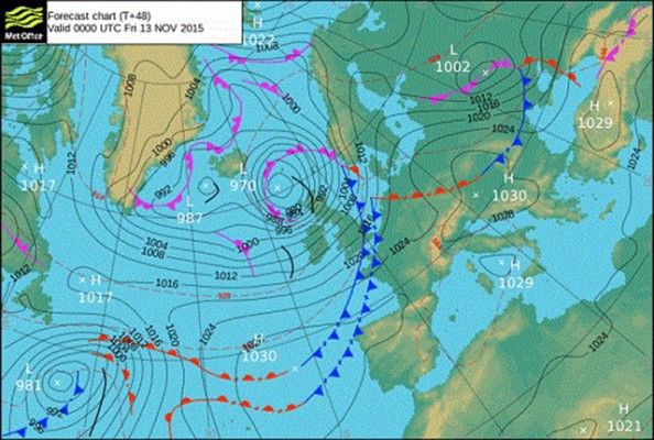
Storm Abigail, the first storm named as part of the Name Our Storms project, will bring strong winds across the far north of the UK tonight and tomorrow.
The national severe weather warning issued by the Met Office on Tuesday has now been reduced to a ‘be prepared’ amber warning for the far north and northwest of Scotland.
The storm has the potential to cause some disruption in these areas as a deep low pressure system crosses to the north of the UK.
Storm Abigail is the first storm named by the the UK and Ireland’s National Met Services, the Met Office and Met Éireann’s Name Our Storms project.
Across the far north and northwest of Scotland including the Western Isles and Northern Isles, severe southwesterly winds are forecast to develop with gusts of 70-80mph, perhaps increasing to storm force for a time with gusts of 90mph in exposed locations before the winds gradually ease tomorrow.
Much of central and northern Scotland are likely to see severe southwesterly gales later todayy with strong winds extending to eastern areas and across the Northern Isles into tomorrow morning. Gusts of 60-70 mph are likely with the possibility of some gusts exceeding 80mph in exposed locations.
An additional hazard will be lightning associated with squally showers circulating the storm system.
Paul Gundersen, chief operational meteorologist for the Met Office said: ‘With wind gusts reaching 70-80mph widely across the warning area with gusts of 90mph in exposed locations there is the potential for disruption to transport, including ferries and power supplies. The strong winds combined with high tides are likely to cause overtopping of coasts and causeways leading to additional hazards.’

‘Mary’ and ‘Barney’ among storm names chosen by the public
The Met Office and Met Eireann have announced the list of storm names chosen by the public for autumn and…

Two Atlantic storms to bring strong winds to northern UK
Severe weather warnings have been issued as gusts of 100 mph are forecast for the most exposed regions

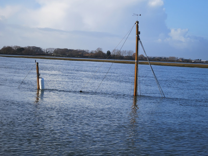
Storm surge breaches
One year on from the biggest UK storm surge for 60 years, new aerial photos have revealed details of breaches…
Yachtsmen warned of navigational hazards following storms
The latest in a string of violent storms has left a trail of navigational hazards around damaged coastal regions
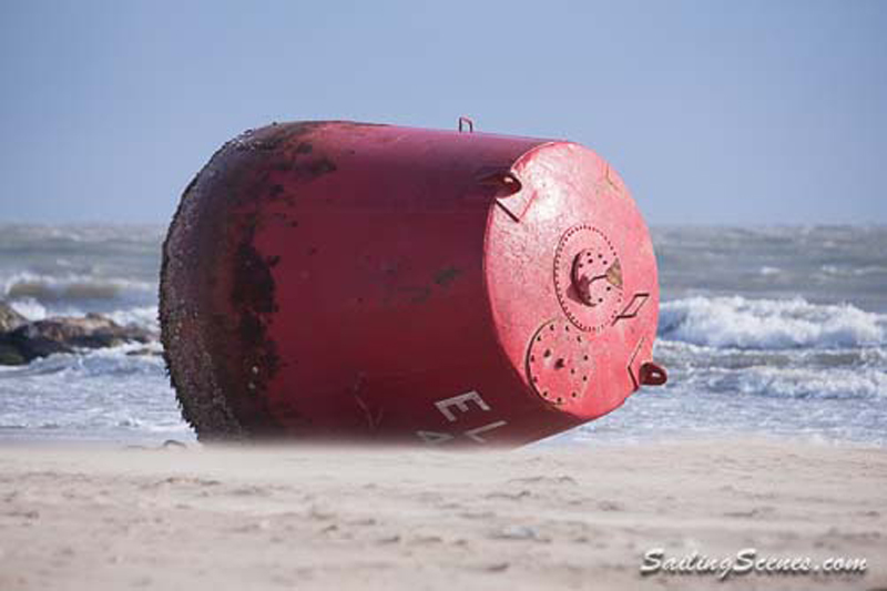
Large red buoy blown ashore by storms
Poole Harbour Commissioners are advising mariners to navigate with caution after two buoys are misplaced

Surge in boat insurance claims following storms
Batten down the hatches - there's more extreme weather on its way!

Strong winds, rough seas and a storm surge
Weather warnings as an Atlantic storm brings a North Sea storm surge to parts of the UK

Storm rescues for boat owners
Three killed and houses, boats and cars damaged by St Jude's Storm
Warning to boat owners to secure vessels against storm
A major Atlantic storm is set to move across the UK over the next 24 hours

Storm-lashed solo sailor rescued
The yacht's sails were 'blown out' by severe weather conditions

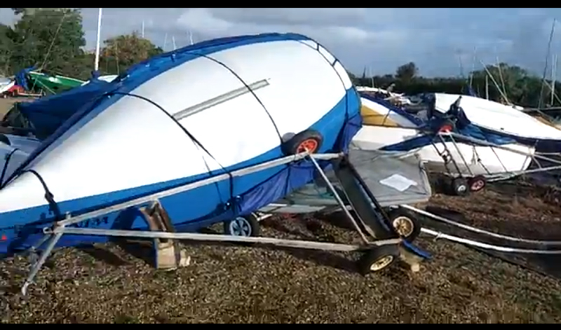
Leaving your boat in storms
Windy weekend - leave her safe and secure