
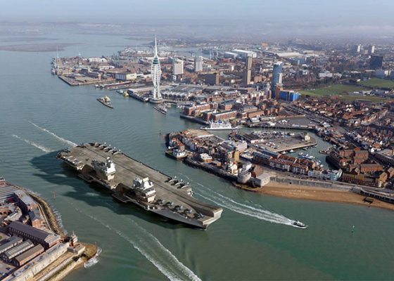
A new Admiralty Chart has been published to show the changes made to the approaches into Portsmouth in preparation for the arrival of the Royal Navy’s new Aircraft Carriers.
Issued by the United Kingdom Hydrographic Office (UKHO) on 2 March 2017, it reflects the characteristics, positions and directional light orientations as well as navigation marks, port entry lights and marker buoys that are now in place.
The Queen’s Harbour Master Portsmouth, Steve Hopper said: ‘The most significant changes include a widening of the approach channel and a change to its route. The new ‘Castle Pile’ which has been placed between Southsea Castle and the War Memorial, now leads ships into the approach channel. Southsea Castle light, which has been used by ships for this purpose since being commissioned by the Admiralty in 1828, is no longer an operational lighthouse but very much remains a landmark in the Solent.’
The Admiralty Chart number 2625 shows the latest surveyed depths in and around the Approach Channel, as well as the positions, names, and characteristics for the Channel’s lateral marks, the positions of new port entry lights and re-orientation of the Fort Blockhouse directional light.
It also includes amends to the notes and the new position of the Small Boat Channel which has moved further to the west. The majority of lateral marks have retained their names and have relatively corresponding positions within the new channel as to the old one.
However, Ridge buoy has been moved to between Outer Spit Buoy and Spit Refuge Buoy, and been renamed Spit Elbow.
Further noticeable changes include the appearance of large yellow piles in vicinity of Spit Bank Fort and in the upper harbour. These, among other specific marks, will be used by the Queen Elizabeth Class Carriers when they come in to and depart from the harbour, when specific navigation lights will be switched on; they will ordinarily display anti-collision lights to alert other port users.
Entry and exit of the carriers will have some impact for small craft, including brief closures of the small boat channel and a 250 metre moving exclusion zone around the ship during entry and departure, but wider impact for leisure craft will be minimal.
The new charts are available for purchase now, while some electronic charts are yet to be updated.
Details of the new positions and characteristics of all the affected navigation mark and light changes are published in QHM Portsmouth’s NAVWARN 26/17.

QHM praises punishment for jet skiers who ran amok in Portsmouth Harbour
Two jetskiers who ran amok in Portsmouth Harbour have been fined for their actions – which included delaying the departure…

Nav in a nutshell: Electronic charts
Dick Everitt assesses the differences between raster and vector charts when deciding on which chart plotter to buy
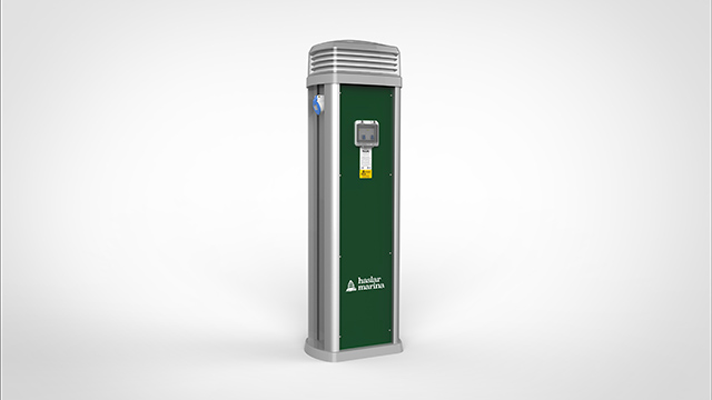
£1.5million to be invested in Portsmouth’s Haslar Marina
Haslar Marina is installing Rolec’s new electricity service pedestal and upgrading washroom facilities in the first phase of improvement works.…

Nav in a nutshell: Coping with currents
Dick Everitt explains how sailors can apply knowledge of tidal streams to ensure that water flow is a help, not…

New marina initiative to reduce the risk of spreading invasive species
Haslar Marina in Portsmouth Harbour has teamed up with The Green Blue to run an initiative that aims to reduce…

Nav in a nutshell: Know tidal vectors
'It’s easy for any sailor to remember how to draw tidal vectors with a handy little aide-mémoire!' Says Dick Everitt.…

Nav in a nutshell: Making comfortable progress to windward
Why make heavy going in choppy conditions when a less demanding alternative heading will get you to your destination in…

Nav in a nutshell: Navigating at night
There’s no need to be in the dark if your preparation is thorough and easy to understand, says Dick Everitt…
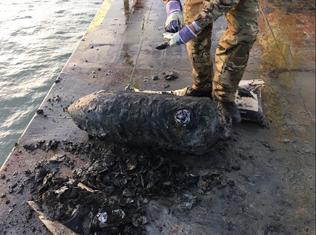
Royal Navy experts deal with German bomb found in Portsmouth Harbour
A 500lb German bomb was found in Portsmouth Harbour during dredging work ahead of the arrival of HMS Queen Elizabeth.
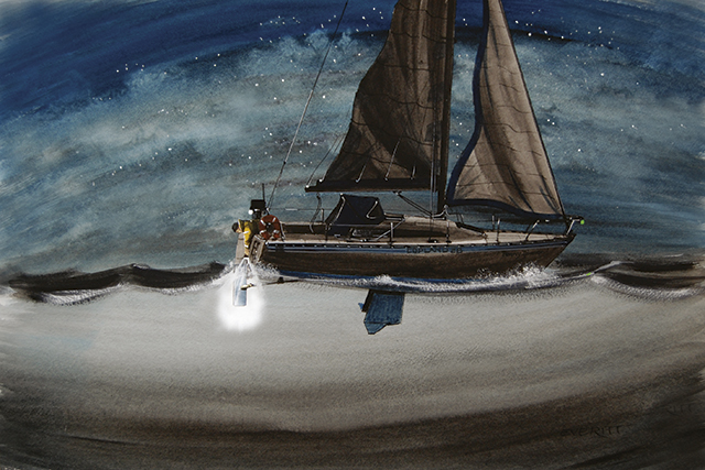
Trapped in a locker in a sinking yacht
As if loss of steering and starting to sink wasn’t bad enough, John Broadhead was forced to keep a cool…

Nav in a nutshell: How to deal with wind shifts
Tacking inside a ‘cone’ can help you to harness changes in wind direction, explains Dick Everitt.

Navtex: obsolete or essential?
Has Navtex been superseded by smartphones and the internet, or does it still have a role in modern sailing?